Peak of Mulhacen
Baggin’ Peaks: MulhacÉn
Oh September, how have I missed you so dearly. You are still warm, comforting, mild and inspire many new activities that I typically shy away from in July and August. This includes basically every single outdoor activity in the south of Spain expect for water sports or beach life.
This idea of climbing the tallest peak in Spain has been in the back of my mind for a while now. Now all we needed was to find our preferred route to the top and wait for the most important aspect: good weather. Not that kind of get out of the shower and you are already sweating again weather. This was the time and the time was now. We were both lucky to get a 3-day vacation and jumped at the opportunity knowing the weather would be kind. So we sent it to our base camp: Trevélez for a night to acclimate and prepare for our ascent the next day.

Base Camp: Trevélez
Trevélez is Spain’s highest pueblo (town) located at a nice 1,476m in elevation. Known for its air-cured jámon, thanks to the dry high altitude climate. We spent our first night in Camping Trevélez and enjoyed walking through the steep streets and allies, followed by a nice big local mountain dish called: Plato Alpujarreño, very similar to our beloved Platos de los Montes here in Málaga. A must get dish after a long day on the trail or if you wish to take a required siesta afterwards (food coma).
Our plan was to set out early in the morning and spend a night up in the high elevation alpine fields near the summit of Mulhacen. The previous day a local advised us that the area of 7 Lagunas was an excellent area to camp for the night and summit the next morning. I checked my map, found 7 small pieces of water on my map and thanked him for his beta he had advised.
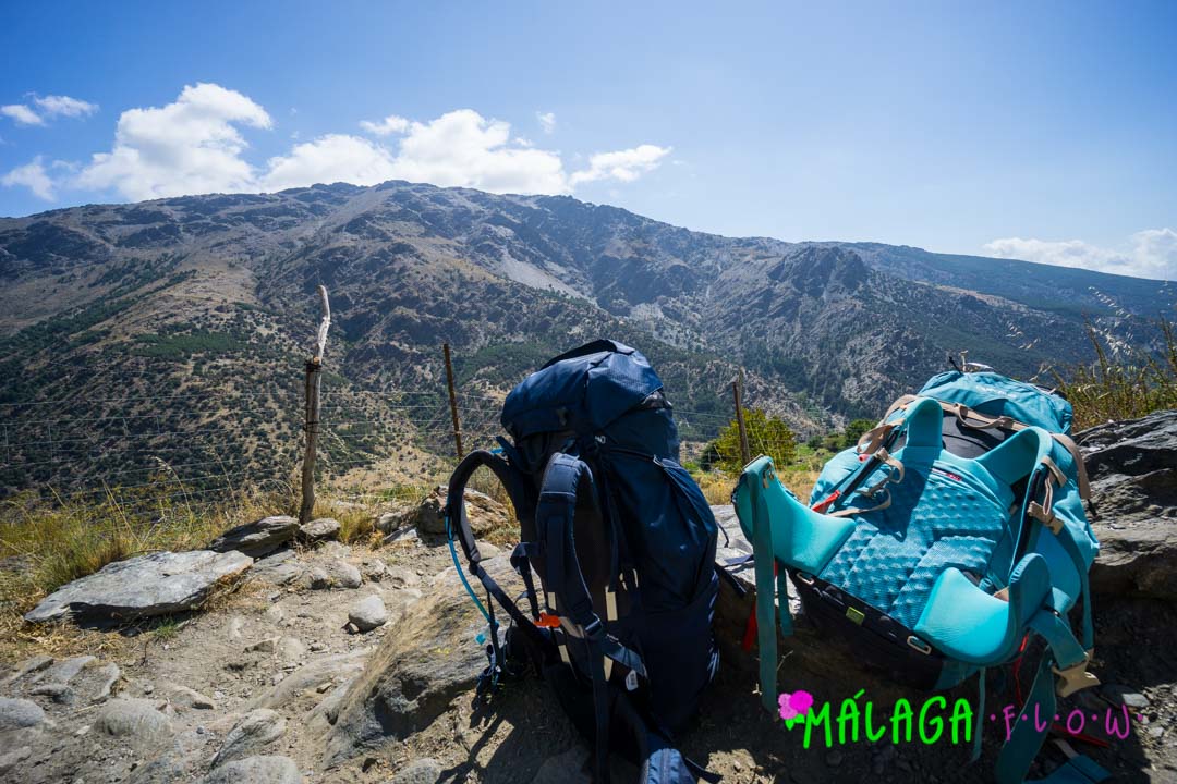
Every Gram Counts
If you have ever gone backpacking before you most certainly know that every gram you carry on your back counts. So anything that you will not absolutely use and need during your time on the trail will need to stay in the car or at home. Your body will certainly thank at the end of your trek. Maria had a hard time grasping this concept when I first met her and we started doing these longer multiday backpacking trips throughout the United States and Spain. “Maria, why you do need your wallet? Do you plan on paying the squirrels with your Visa credit card for some nuts or are you just hoping someone will have cold beer for sale on the side of the trail?”
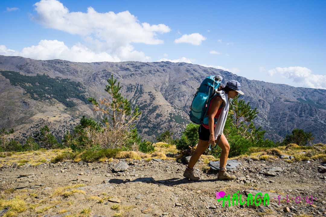
The Route Begins…
Without further ado let me allow the photos to now do some of the talking and stop making fun of Maria and why she thought she needed a hair dryer on the trail.
Parking
There is a great huge parking lot that you can leave your car parked for a few days without having any worries of having a parking ticket or boot on your tire when you return. This is also a great place to park for day hikes and also seeing the town in general. See interactive map below:
Public Parking
Distance from Parking to Peak
Kilometers
Miles
Elevation Gain: Parking to Peak
Meters
Feet
Elevation Decline: Parking to Peak
Meters
Feet
Trevélez to Mulhacen and Back
- Feeling strong and you have a quick crew? I recommend this route and can be found with more information here (its in Spanish but feel free to use a translator app and that should get the job done), note this route can be done in one day or you can break it into a multiple day trip.
- Wanting to take your time, enjoy yourself, not be rushed and enjoy the high alpine scenery on your way to the top? This is what we did so feel free to try the same and experience it through my camera lens.
- If you are short on time and still want to summit Mulhacén. It is possible to do in only a few hours! During the summer months, there is a bus service that takes you from the small town of Capileira to the Mirador de Trevelez at 2700m. From there you can walk to the summit in about 2-3 hours via the less challenging South Ridge. But please note, the bus must be booked in advance at the tourist information centre in Capileira. See their site here.
But please remember you are in high elevation and the trails iare steep and technical. Expect for the best, prepare for the worst and capitalize on what comes.
Our Route…

Moka is ready?! Are you?!

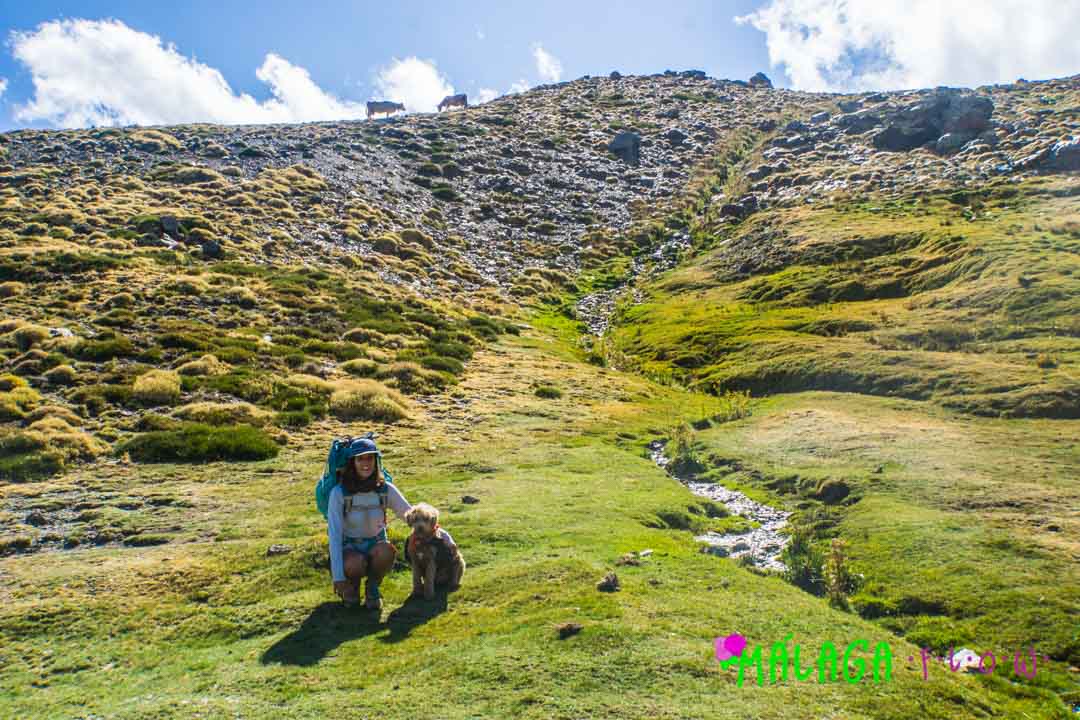
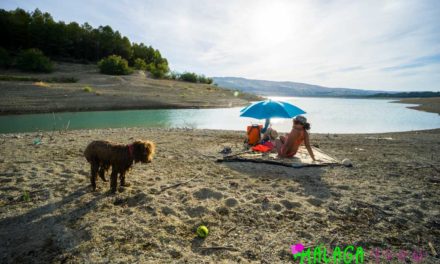
Maria and Moka playing tourist in one of the many high alpine meadows.

Moka enjoying the mountain streams that you cross on your way up to 7 lagunas

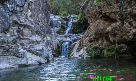
We enjoyed a nice snack and a drink of water below this beautiful waterfall.

We are getting closer…
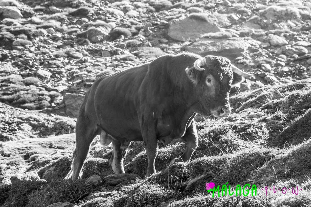
Mess with the bull, you get the horns…

Your facial expression when you are really determined to reach camp before dark…

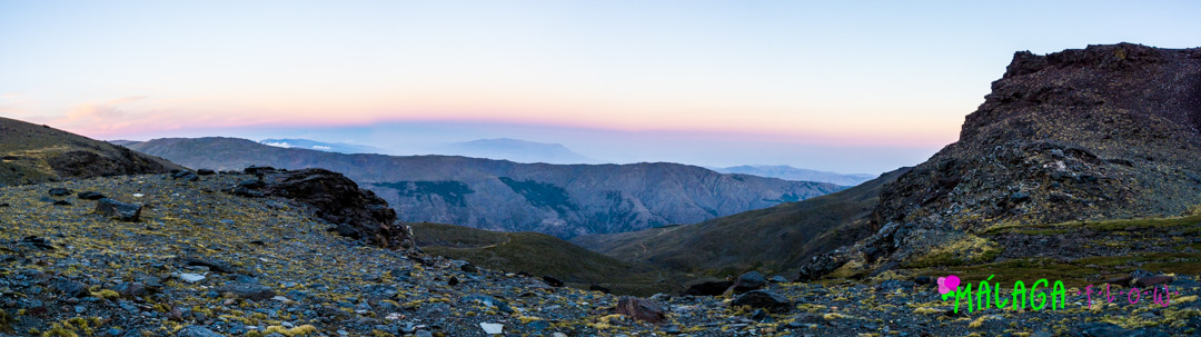
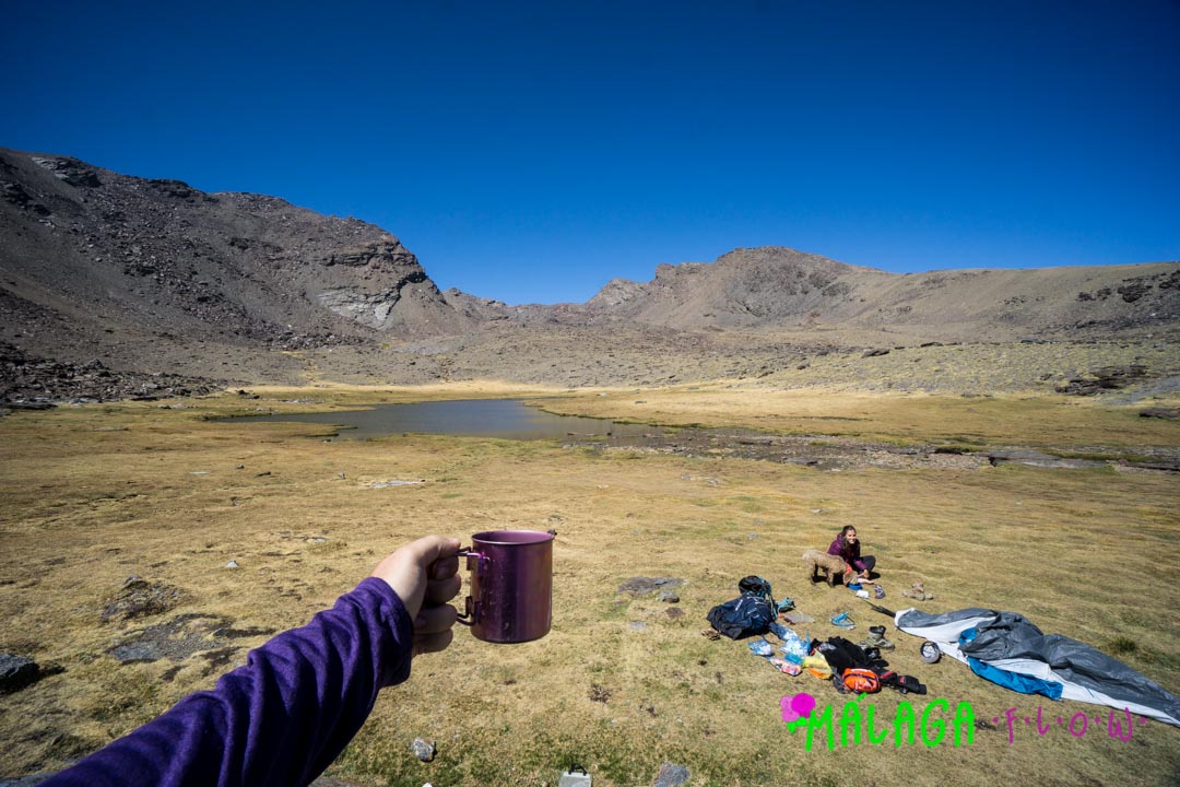
Finally making it to 7 lagunas right as the sun was setting over the top of Mulhacen and Alcazaba. The panorama doesnt do it justice with how huge these peaks actually are.
The view from our tent.
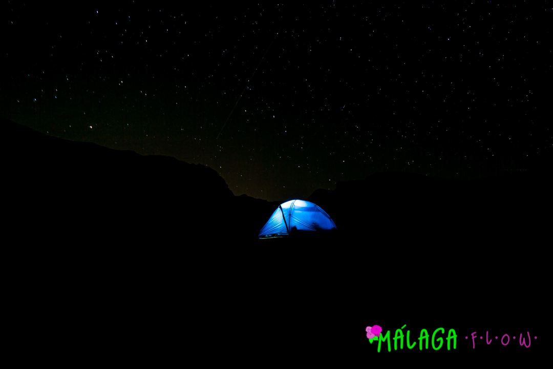
The stars are absolutely astonishing on a clear night from 7 lagunas. No light pollution, just you, nature, and the universe.

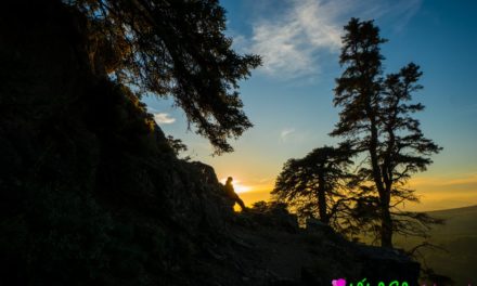
GOOD MORNING! You can see the lake below from where we slept the night before. Best to wake up early and hit the trail. Today was going to be a loooong day.

Up, up, and away we gooooo! The view of the south ridge. There is a refuge that sleeps around 10 people right below the lake. A good option if you wish to do an ultralight setup and skip bringing a tent.

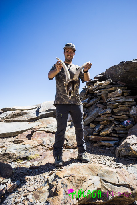
The customary victory photo ✌?

And the customary victory dance…

And finally the customary victory siesta at 3482 meters above sea level ??
With still a really long day ahead of us and our lunch supplies hidden with a lot of our other gear down below back at 7 Lagunas, we started our descent. It was quite a nice change of pace for the legs after only hiking uphill the last day and a half.
Lunch, repack, and some stretching down at 7 Lagunas before we sent the last long push back to Trevélez before dark
Keep your eyes open, you never know what you will find!

The locals in Trevélez said you can drink from the streams and river, but a word of caution! We saw a lot of cow, goats and sheep enroute to Mulhacen. From my personal experience when livestock is deficating near streams or rivers it is ideal to purify before consumption.

The trail never seemed to end and someone was starting to hit a wall…

Maria finally hit that wall and I think the photo above perfectly sums up how we were both feeling after a very long day. But thankfully I know how to quickly and efficiently motivate Maria into pushing those last few kilometers. It is inviting her to one of two things, Pizza or a Cheeseburger. I told her a double cheeseburger, fries and a cold beer was waiting for at the car. To no avail, she was up before I could finish my sentence and hiking full speed down the trail.
With light to spare, we made it back to the car in one piece and soon after loading the car the next adventure started: where to find a double cheeseburger in a pueblo at 6PM knowing most kitchens dont open until 9PM. Seemed like mission impossible, but we were up to the challenge.
We hope you enjoyed our experience hiking spains tallest mountain and hope that you can also make it to the top of Mulhacen one day. But until then, we hope to see you out and about, enjoying life to the fullest.
Besitos,
The Malaga Flow Team: Geoffrey, Maria and Moka!


